Chase Report: 26 Mar, 2011- Crazy in Alabama
Wall Clouds, Funnels, Phantom tornadoes
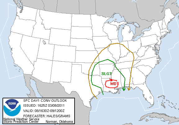
Left Austin about 4:45 a.m. (all times CDT). Initial target was Winona, MS, where parameters looked most favorable for afternoon/evening supercells. SPC upgraded a chunk of MS/AL/W GA to MDT on the 1630 Day 1 outlook:

Around the time I was crossing the MS river on I-20, storms fired and rapidly became supercellular near Meridian, MS. A TOR box went up for a swath of AL and GA for this activity. Numerous supercells produced numerous tornado warnings for the next several hours across the watch area. Rather than try to catch this activity, I elected to stick with my original target and turned north on 55 in Jackson. Realistically, I don't think I could have gotten into the initial action in time in AL and GA, and terrain in that area is among the worst I have chased in.
Moving north along 55, I crossed the damage track of the 4/24/2010 Yazoo City super tornado. A swath of trees at least .5 miles long on both sides of the interstate were literally sheared off not far above the surface (20-30 ft). I have seen this signature before from other violent tornadoes- Limestone County AL, 5/18/1995 among others.
Arrived in Winona 2:45 p.m., with clear blue skies and surface temps in low 80's. Quickly noted surface winds were SW, which did not bode well for low-level rotation. With nothing anywhere nearby, I decided to wait, as I was at least near the warm front, and HRRR was showing cells popping in the 22-0Z time frame near my location.
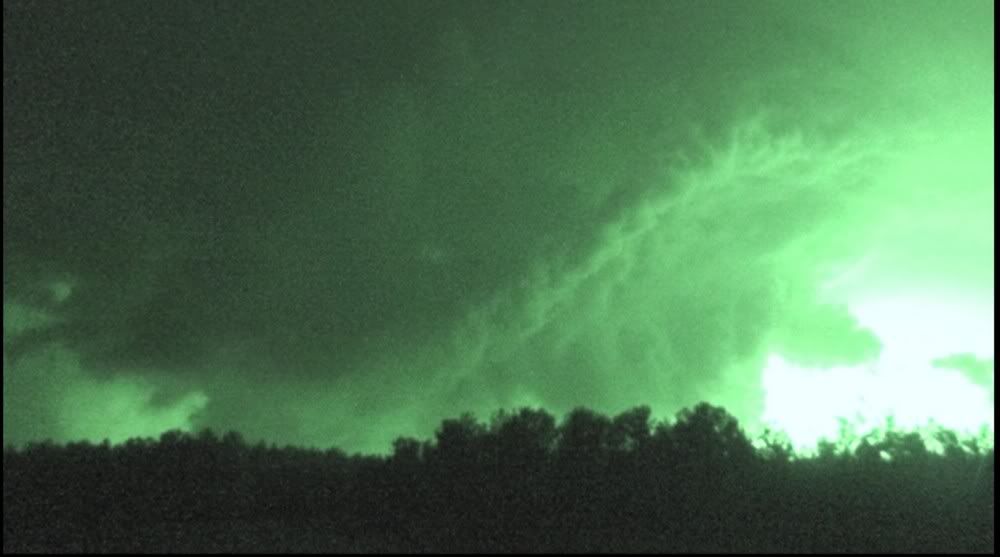
Around 5 p.m., I noted a tower had popped up to my NE. It did not look like much, but I immediately turned back east and went charging after it. A new cell had popped South of the line in North MS, and was now showing up on radar, albeit only weak echoes. As it began to strengthen, it became apparent that it was well ahead of me, 60-80 miles to my NE, and my prospects of catching it weren't great. I had to hope that it would move ESE and track along the warm front and into the moist tongue, which is exactly what it did. I cut NE on 12 at Columbus, MS, with a nice view of the strengthening cell to my NNE, complete with anvil and hard tower. Time is ~6:27, view NNE:

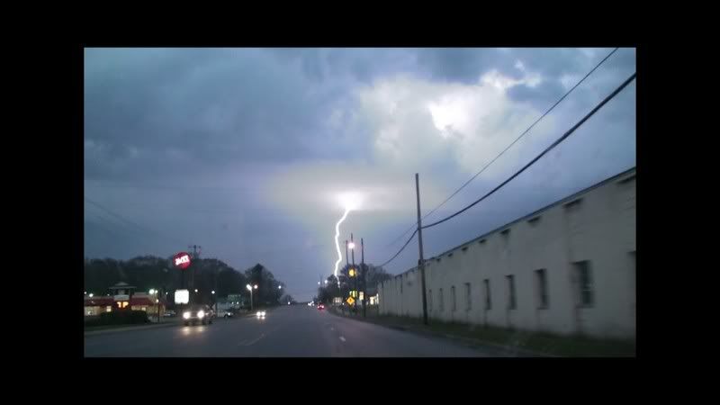
About the time I crossed into AL, the storm went tornado-warned. I got to Guin, AL a few minutes behind the circulation, and noted a possible lowering obstructed by the Guin downtown buildings. No good shots of the lowering at this stage, but one nice lightning capture as I went through town. Time is ~7:20, view is east:
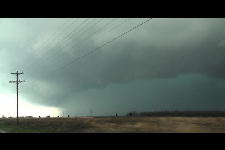
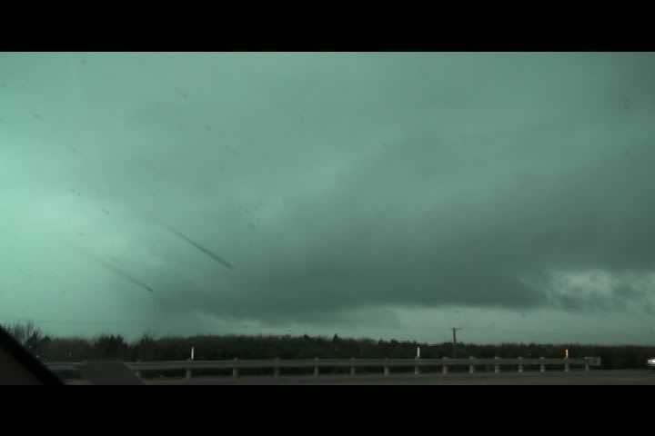
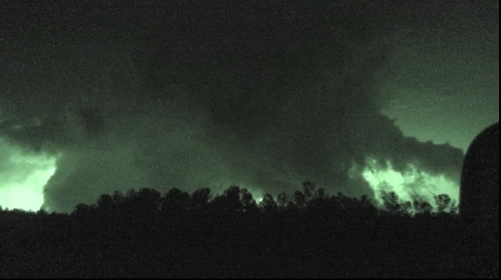
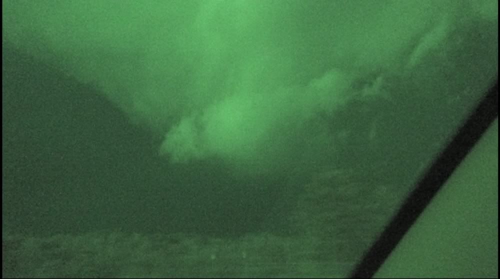
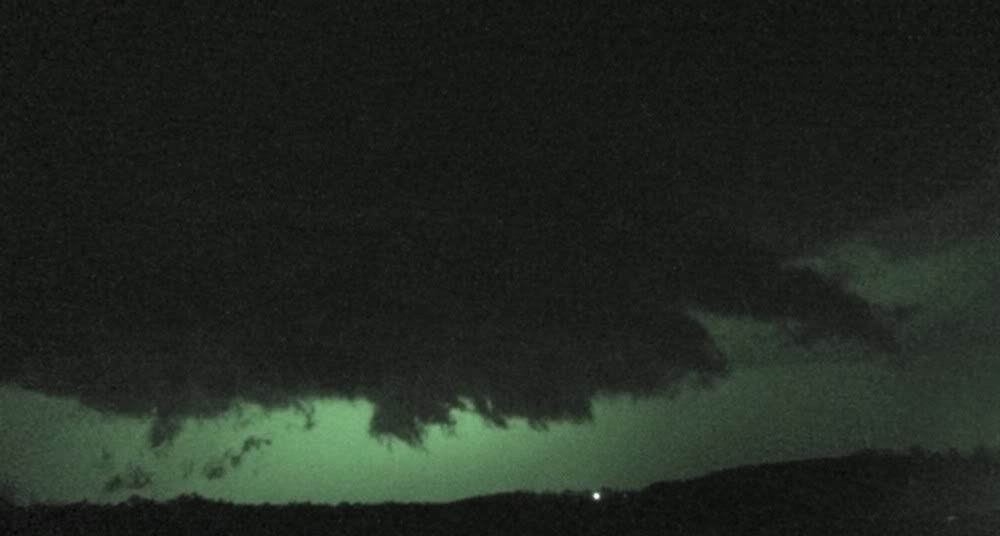
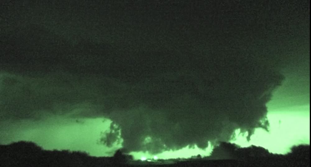
I took 118 E out of Guin through Winfield and Glen Allen in dwindling daylight, continuing to note possible lowerings to my East. I finally approached the radar-indicated circulation near the town of Eldridge, and noted a solid wall-cloud south of my location near Eldridge. I reported this and continued east on 118 through Carbon Hill and onto the I22/78 corridor. Stopped just West of Jasper at 7:58 with a large Wall cloud to my immediate south. Here is the location and appx. look angle of the next few screen grabs:

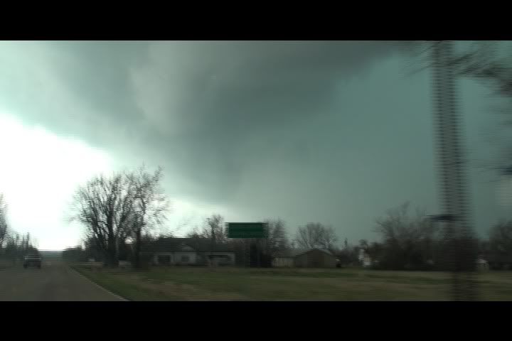
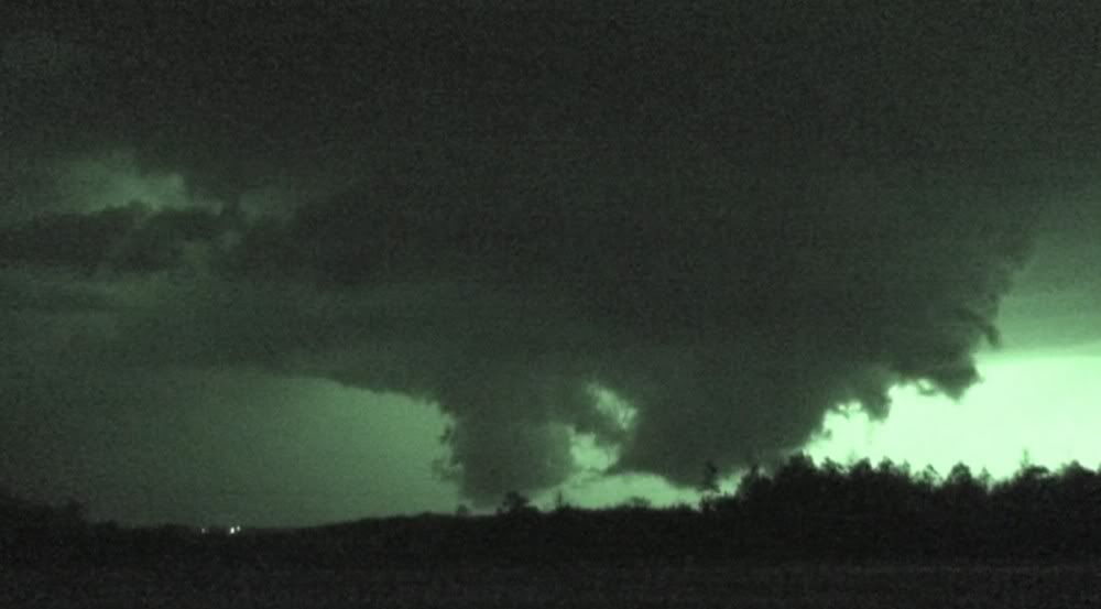
A couple of moments later, what appeared to be a funnel cloud became evident. Upon careful review of the video, it looks like the funnel is actually behind the wall cloud. Here are a couple of captures:
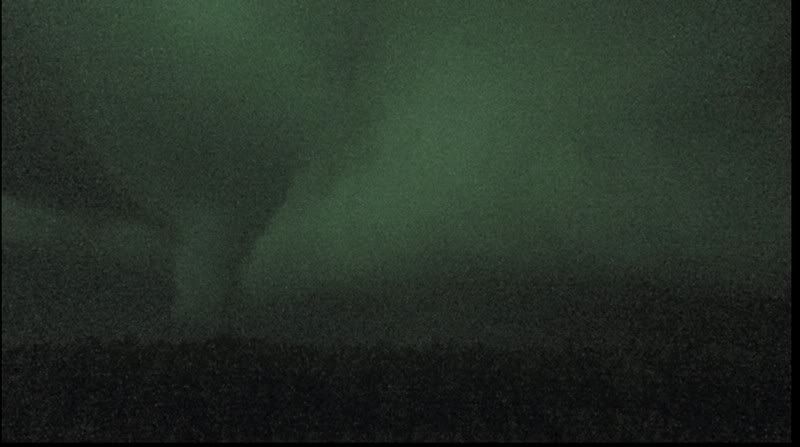
I began to get rain and small hail, so proceeded ESE on 22/78. Got a couple more looks at the funnelish feature while moving:
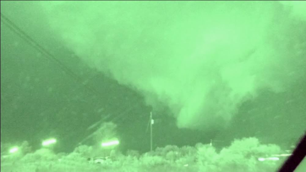
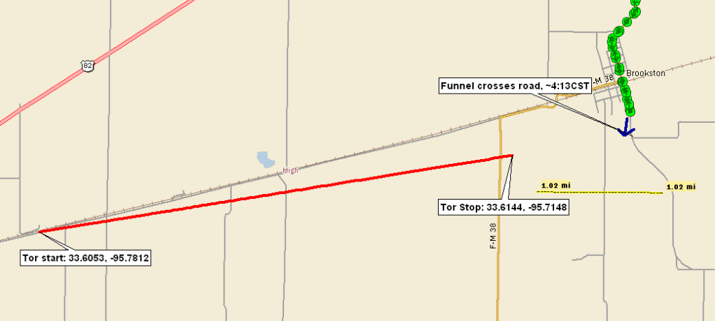
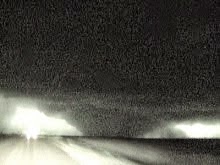
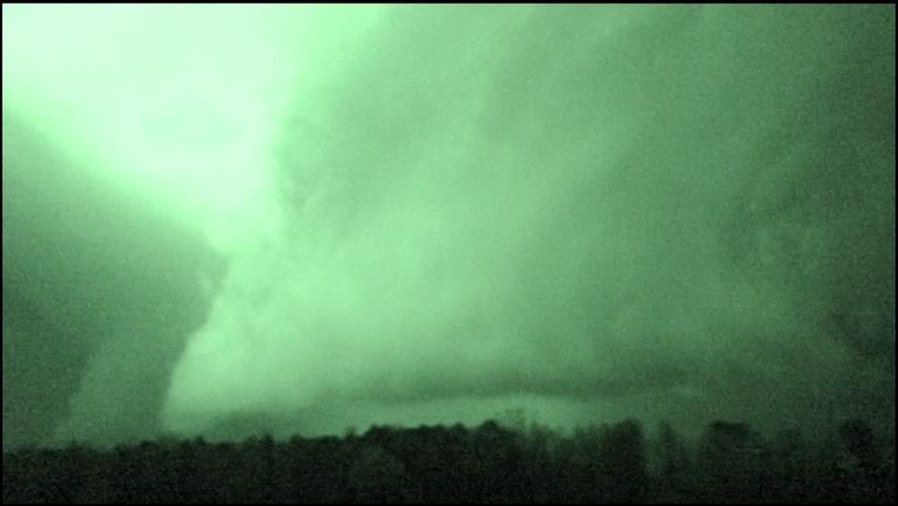
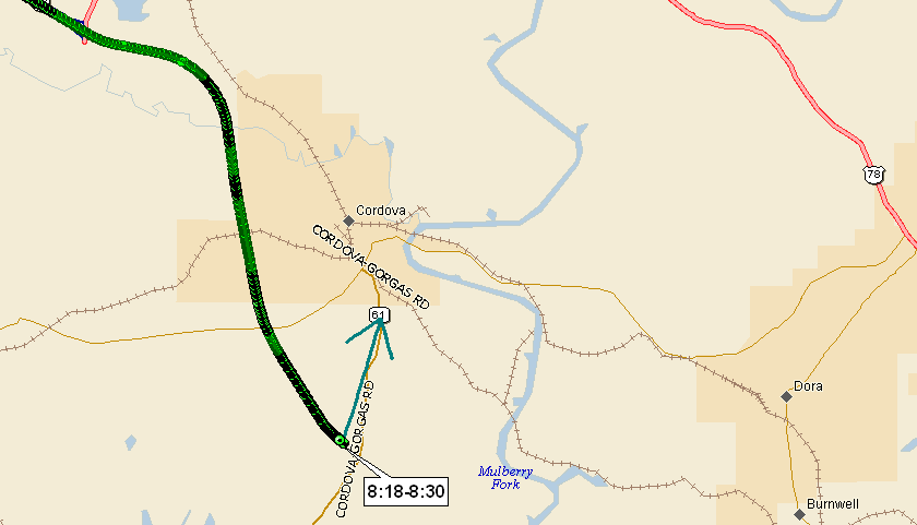
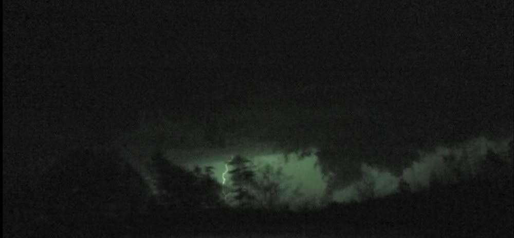
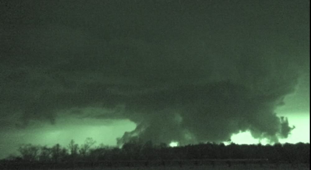
At 8:18, I stopped again. Talked to some other chasers, who alerted me to a new circulation just to the North of the highway, in the vicinity of Cordova. At ~8:26, I filmed an ominous wall cloud with protuberances for several minutes. Terrain blocked the lowest level of the feature. Over the next 30 minutes, it would exhibit double wall cloud structure, funnels, inflow tail, and essentially everything but a confirmed tornado. Location and appx. look angle:


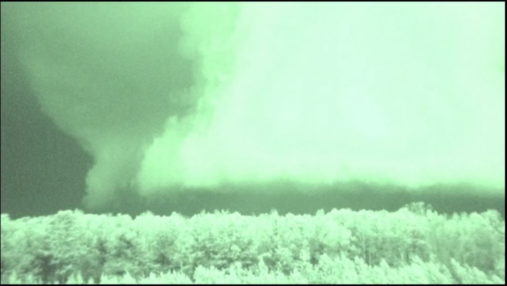
Continued ESE on 22/78, filming the area of ciruclation and stopping occasionally. I never saw evidence of a tornado on the ground. During this time, spotter reports of a large tornado prompted continued tornado warnings. These reports turned out to be erroneous, although from my visual evidence at the time, I did not doubt a tornado was in progress.


Despite all these ground-hugging wall clouds, funnels, etc., NWS BMX has not surveyed any tornadic damage from this cell to my current knowledge. That doesn't mean it did not produce briefly a time or two along its path, but without an official damage survey, the video evidence does not support calling any of these features a tornado. The wall cloud/circulation began to get further to my east, and about that time, my outdated version of Delormes had me in the middle of nowhere. Had to call a friend to get me back on track. Made it back to 65, by which time the tornado warning had been canceled.
I stayed on the 65 corridor north of Birmingham for another hour, picking up a couple more cells as they crossed the interstate. Did not see anything else of note, though. Headed towards home, and made it as far as Meridian, MS. Stayed the night in the Relax Inn on the north side of the frontage road on I20 in Meridian. Wasn't the worst dump I have stayed in, although every time I flushed the toilet, water shot out the back of the tank lid. Here is the full GPS log of the chase up until just south of Birmingham, where I disabled the GPS:

Got up Sunday and drove back to Austin. Special thanks to Bill Tabor for providing nowcasting support during some of the hairier moments of the chase.
Depart Austin, TX: 4:45 a.m.
Arrive Meridan, MS 1:00 a.m.
Solo chase
1165 miles, 20h15m
1855 miles 2-day round trip total
posted by Tony C at
11:44 PM
0 Comments
![]()