Chase Report: 22 Apr, 2010 - Stuck in the Middle
Finally got a chance to look at models again, mostly 12Z WRF. Still like it. Looks like the best low-level directional shear is going to be North of 40, near/east of the surface low. Best CAPE in NW TX/Childress... Hard to nail down a target, but I like a relatively narrow swath from Childress N/NW to SW KS. Plan to leave early towards Childress, and assess from there. Will have to commit early to make OK Panhandle/SW KS target.
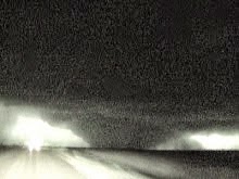
Indeed, I made it to Childress with plenty of time to spare. Decided to head north, which would give me the option to double back south if northern storms fizzled. Came upon my first storm near Hooker, OK, which produced a beautiful, low wall cloud. The wall cloud persisted for a long time (?), producing wispy funnels. Looked like a tornado was imminent several times, but never saw evidence of ground-level circulation. First three images are south of Hooker, time ~2035Z. Position and look angle:
Wall cloud with thin funnel N of Hooker:
As the Hooker cell moved north and weakened, I met up with fellow Austinite Randy Denzer, and we decided to head south to pick off a series of three training supercells in the North TX Panhandle. Randy had to make a stop to do a streaming bit with TWC? It was the last I would see of him all day. He went on to catch 4 tubes in SW KS.
I caught the training supercells and positioned myself just East, watching the updraft regions translate past me. Had perfect position, and observed a few wall clouds and lowerings. The storms began to interact, although they remained discrete. Data feed was slow and completely down at some points during the next two hours. Occasionally, wall clouds would form, and produce funnels, some of which got very close to the ground. Inflow into the storms was insane, reminiscent of May 22, 2008 in Kansas. Not quite that strong, but certainly stout enough to support tornado development.
Not sure why the cells I was on failed to produce tornadoes. Further south, where CAPE was higher and inflow was warmer, tornadoes were numerous. Further north, where shear was higher and low-level flow was backed more, tornadoes occurred. I would guess the low-level winds just weren't sufficiently backed, and sfc. temp a little on the cool side (upper 60's-low 70's) may have resulted in lower CAPE values.
The scenario actually played out just like my forecast. In the field, though, I elected to alter my chase strategy and play between my two target areas. I would say "lesson learned", but not convinced I made a bad decision. The one thing I should have done a little better was stop and look at Mesoscale analysis params before dropping south. I am guessing that a close look at the models would have indicated unfavorable surface winds in my area. Not sure, though. I should really study this case a little more.
Finally called it a night and stopped in Watonga, OK, to prepare for the next two days. Here are a few shots/vid from Austin chasers who caught tornadoes this day:
Bill Tabor pic of awesome Goodnight, TX tornado
Randy Denzer video of Kansas tornadoes
Depart Austin: 6:20 a.m.
Arrive Watonga, OK: 9:00 p.m.
710 miles, 14:40h
Solo Chase


0 Comments:
Post a Comment
Subscribe to Post Comments [Atom]
<< Home