Huntsville, AL tornado- Jan 21, 2010
At around 5:30 CST on January 21, an EF2 tornado touched down in the historic Five Points district of Huntsville, AL. I was watching the cell that produced the tornado on GRLevel 3 as it approached Huntsville from the SW. It appeared to weaken while over Decatur, but ramped up again quickly once it entered Madison county.
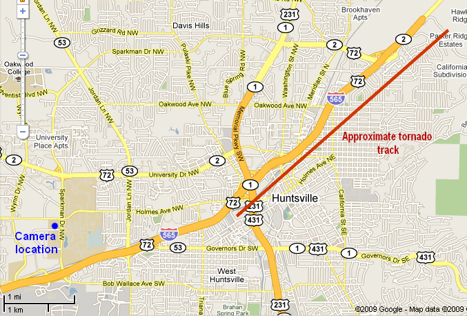
I was able to track the tornado and snap a few pics with two web-cams set up at the NSSTC, located in Huntsville by the UAH campus. One of the cameras sits on the roof of the building, and the other is positioned in a third floor office facing east. On this day, I was operating the cameras remotely from my home office in Austin, Texas. This makes these my first tornado catch of 2010, from over 900 miles away! Here is a map showing Camera location and approximate tornado track:
The lighter images are from the rooftop camera, which had focusing problems due to rainwater on the camera lens. The darker images are from the 3rd floor camera. The timestamps on the dark images are 2 hours and 10 minutes ahead. The view is initially to the S/SE, and then rotates to E and E/NE as the tornado touches down in the distance.
One of my former classmates from UAH, Dr. Tim Coleman, is now a meteorologist at ABC's Birmingham affiliate (33/40). He created a time-lapse sequence of the images and posted it on their weather blog here:
Time-Lapse sequence
Here are a few of my favorite shots:
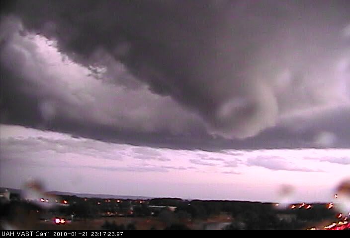
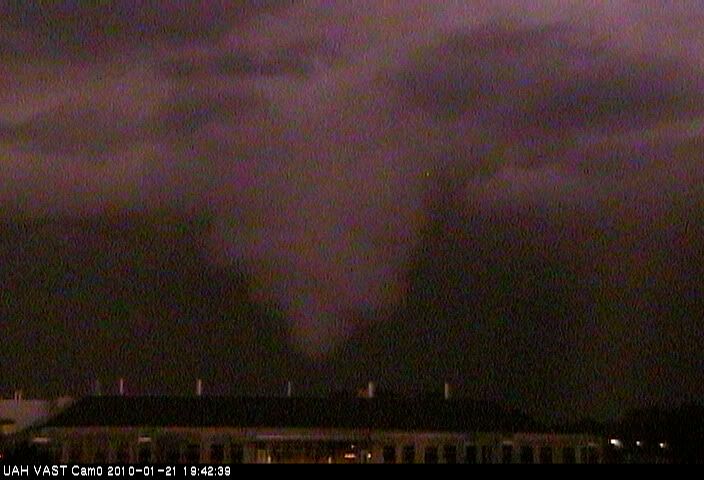
Bulbous wall cloud forms. View is SE, time 5:17 CST:
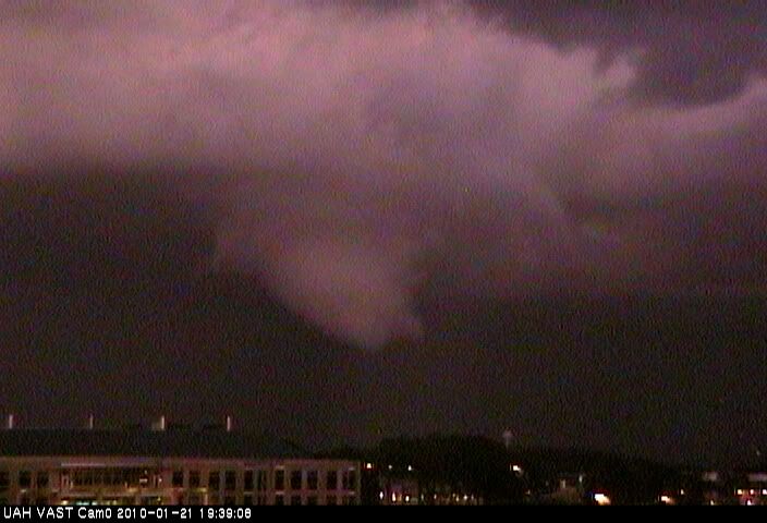
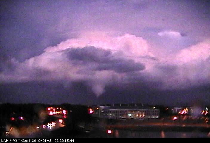
Funnel forms and begins to descend. View is E. Time 5:27 CST:
5:28 CST. Funnel approaching ground. View is E:
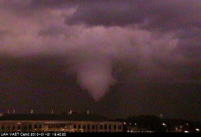
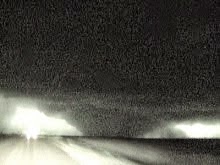
Rooftop view of tornado approaching the ground at 5:29 CST. Note the low-topped nature of the storm. View is ENE:
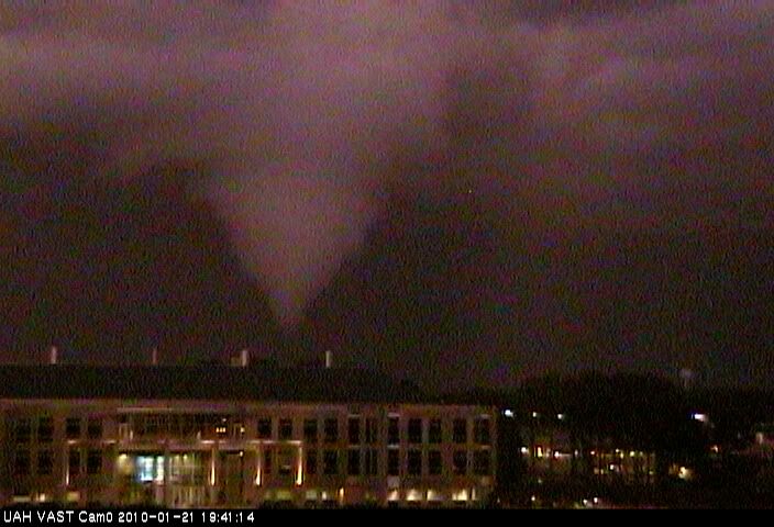
5:29 CST. Tornado likely in contact with the ground. UAH Campus in Foreground:
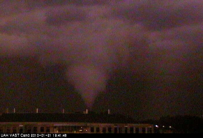
5:30 CST. Tornado continues:
5:31 CST. Tornado continues:
This storm was interesting in a number of ways. It formed in a relatively low dewpoint environment (56, I think). The storm was tail-end Charlie at the time. The rooftop shot above shows the low-topped nature of the storm pretty well. The best directional shear was in Eastern Tennessee and Kentucky. The SPC Meso-analysis was showing mostly linear shear by 5 p.m. in North AL. The storm occurred outside the Tornado watch (which may have already been discontinued at that time), and the Severe box, which extended only into Southern Tennessee.
Here is the NWS Summary and Storm Survey of the event:
http://www.srh.noaa.gov/hun/?n=january2010_severewx
And here is a bunch of pics of the tornado from various locations, including some of my shots:
http://www.srh.noaa.gov/hun/?n=january2010_severewx-media2#nsstc
I was able to track the tornado and snap a few pics with two web-cams set up at the NSSTC, located in Huntsville by the UAH campus. One of the cameras sits on the roof of the building, and the other is positioned in a third floor office facing east. On this day, I was operating the cameras remotely from my home office in Austin, Texas. This makes these my first tornado catch of 2010, from over 900 miles away! Here is a map showing Camera location and approximate tornado track:

The lighter images are from the rooftop camera, which had focusing problems due to rainwater on the camera lens. The darker images are from the 3rd floor camera. The timestamps on the dark images are 2 hours and 10 minutes ahead. The view is initially to the S/SE, and then rotates to E and E/NE as the tornado touches down in the distance.
One of my former classmates from UAH, Dr. Tim Coleman, is now a meteorologist at ABC's Birmingham affiliate (33/40). He created a time-lapse sequence of the images and posted it on their weather blog here:
Time-Lapse sequence
Here are a few of my favorite shots:
Bulbous wall cloud forms. View is SE, time 5:17 CST:

Funnel forms and begins to descend. View is E. Time 5:27 CST:

5:28 CST. Funnel approaching ground. View is E:

Rooftop view of tornado approaching the ground at 5:29 CST. Note the low-topped nature of the storm. View is ENE:

5:29 CST. Tornado likely in contact with the ground. UAH Campus in Foreground:

5:30 CST. Tornado continues:

5:31 CST. Tornado continues:

This storm was interesting in a number of ways. It formed in a relatively low dewpoint environment (56, I think). The storm was tail-end Charlie at the time. The rooftop shot above shows the low-topped nature of the storm pretty well. The best directional shear was in Eastern Tennessee and Kentucky. The SPC Meso-analysis was showing mostly linear shear by 5 p.m. in North AL. The storm occurred outside the Tornado watch (which may have already been discontinued at that time), and the Severe box, which extended only into Southern Tennessee.
Here is the NWS Summary and Storm Survey of the event:
http://www.srh.noaa.gov/hun/?n=january2010_severewx
And here is a bunch of pics of the tornado from various locations, including some of my shots:
http://www.srh.noaa.gov/hun/?n=january2010_severewx-media2#nsstc
posted by Tony C at
9:28 AM
0 Comments
![]()