Chase Report: 15 April, 2011, Part 1 - De Kalb to Scooba, MS EF3 tornado

After a much needed 3 hours of sleep following a long chase on the 14th, I woke up in Little Rock, AR about 7:30 a.m. (all times CDT). A cursory check of models and I was on the road quickly. As I crossed the MS river at Memphis, noted vast area of clearing SW of the initial line mess moving through North MS and West TN. It quickly became apparent that the odds of a big tornado day were increasing. SPC's 1730Z Day 1 included a hatched 15% tornado probability:

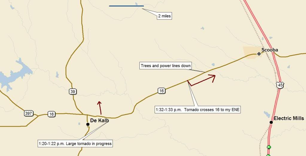
There was already a tornado-warned cell in Jackson, MS (which produced EF3 damage), and north of that, a cluster of cells with embedded tornado warnings to my south. I got to Hwy 45 and decided to punch through the cluster to the more isolated cell that was now east of Jackson. I calculated I could catch it near De Kalb, MS.
Arrived at Scooba at 1:07 p.m. The Jackson cell had maintained a tornado warning the entire time, and was now rapidly approaching De Kalb. I went west on 16 and immediately saw the rain-free base and low broad wall cloud. As I got a little closer, saw the top of a cone below the treeline. The wall cloud above this feature exhibited extremely rapid rotation. Called NWS Jackson and reported possible tornado.
Turned around at the junction of 16/39 in De Kalb and hurried slightly east to try to find a suitable spot to observe the area of concern. Pulled off on Old Scooba Road with a good view to the north and observed a large tornado in progress. It was just north of De Kalb, and crossed my field of view over the next 90 seconds. Called NWS Jackson again and relayed the report.
As the wrapping wain curtain on the south side of the tornado arrived at my location, I moved ENE on 16 to reposition. However, it was soon clear I could not safely outrun the tornado on 16, and I stopped to let it cross the highway. All I saw was a solid wall of white, with rapid rotation in the rain curtains as they crossed. Once the back edge had passed, I continued east and noticed a swath of downed trees and powerlines. I was able to safely continue to Hwy 45 at Scooba.
Here is the video- see Video index and map below for details:
Video index:
0:00-1:02 - Driving west into De Kalb through the intersection of Hwy 16 and 39. Wall cloud and brief shot of top of tornado over the treeline. Time is 1:16-1:18 CDT.
1:02-2:52 - Looking ~north from Old Scooba Road. Wedge tornado crossing to my north. Time is 1:20-1:22 CDT.
2:53-4:00 - Driving ENE on 16 between De Kalb and Scooba- low-contrast back edge of tornado crossing highway. Time is 1:32-1:33 CDT.
And here is my position, time, and approximate look angle of the features noted in the video:
Continued east on 16 hoping to trail the tornado until I could navigate back to the SE of it. Instead, I found a tree across 16, and had to turn around and backtrack. Went up to the next eastward road. Delorme 2011 showed that this road would take me into AL at Geiger:
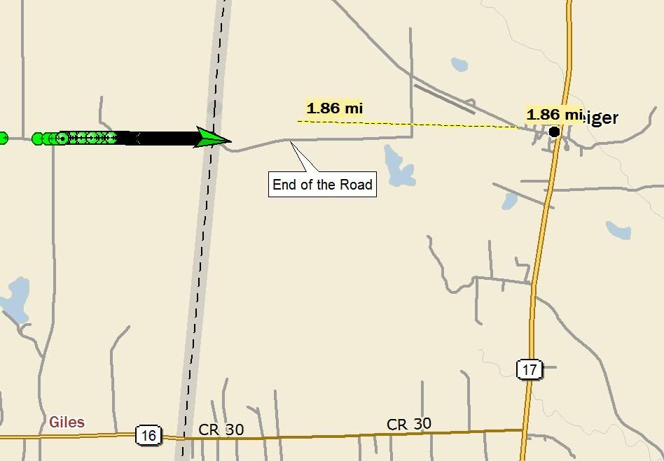
However, after a few minutes of mud and gravel, the road abruptly turned into a grassy, overgrown trail with trees and bushes everywhere:
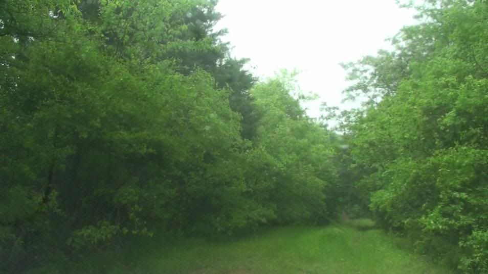
I could see the storm and wall cloud/fat funnel through the trees, but it was moving away quickly. By the time I got back out of the jungle, I decided I could not catch back up to that cell, and moved back to Scooba to catch the next cells in line.
Here is NWS Jackson's summary of the EF3 tornado.:
http://www.srh.noaa.gov/jan/?n=2011_04_15_tor_neshobakemper
and NWS Birmingham's summary (see Geiger, Sumter, AL portion):
http://www.srh.noaa.gov/bmx/?n=event_04152011
From the wording of the NWS surveys, I believe this was the same tornado, with contiguous damage track. If so, it had a path length of 49 miles, width of up to 1 mile, and duration of 71 minutes.
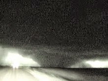
Over the next 6 hours, observed and filmed several big wall clouds and funnel clouds, but have not confirmed any more tornadoes. I will have to sift thru NWS surveys to see if any of the features I filmed is coincident with tornadic damage. A couple of the features I saw obscured by treelines certainly could have been tornadoes. Will update this report with a part 2 once that work is complete.
As daylight waned, there were still warnings in progress near my location. I was physically exhausted, though, and with flooding issues ramping up, and lack of visual on most of the storms by that time, I decided to call the chase. Spent the night in Meridian, MS and drove back to Austin Saturday. Heard reports of the NC tornadoes during my drive.
Depart: Little Rock, AR 8:00 a.m.
Arrive: Meridan, MS 9:00 p.m.
720 miles, 13 h
2245 miles, 3 day round trip total
Solo chase
posted by Tony C at
12:30 AM
![]()

0 Comments:
Post a Comment
Subscribe to Post Comments [Atom]
<< Home