Chase Report: 8 March, 2011 - Lamar/Red River county supercell
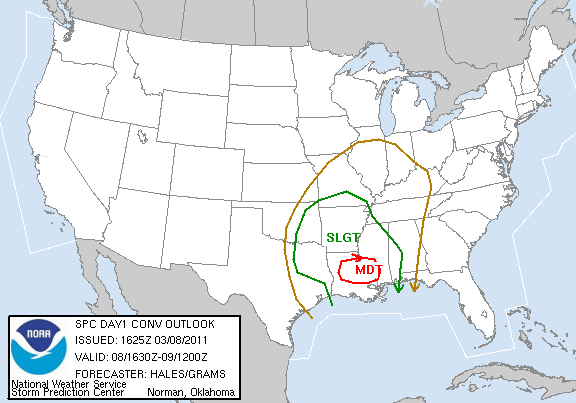
We left Austin around 8:45, There were two broad target areas for the day. First was the dryline which was forecast to be near the I-35 corridor in N TX in the afternoon. Second was the open warm sector, covering most of LA, Southern AR, and SW MS. By around noon, we were heading east on 20 between Dallas and SHV, and briefly toyed with the idea of heading into the warm sector target, which SPC had just upgraded to MDT. The dryline target was a bit more conditional, and also storms along the dryline would be working with less helicity/shear, as the 850 jet was forecast to be translating away from N TX later in the day.
Shortly after 1 CST, convection did fire (far earlier than most models were showing) north of DFW in North Texas. We stopped at Longview, and turned back NW, heading towards this initially small set of discrete cells. Tornado watch went up shortly thereafter for NE Texas and SE OK.
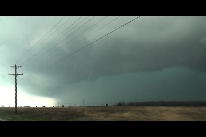
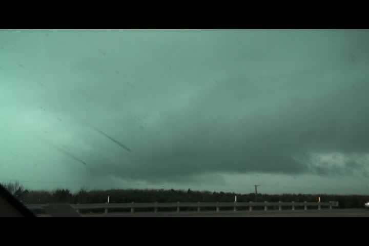
We caught the first cell to generate a tornado warning in western Lamar county near Brookston. The radar-indicated circulation was heading east just south of Hwy 82 in our direction. We were moving south on FM 38 trying to clear the front flank of the storm and beat the circulation. Time is 4:11 CST, view is SW:
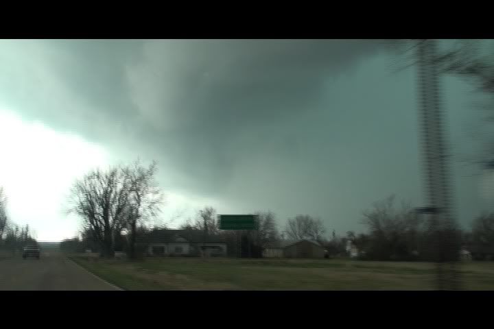
A laminar funnel/lowering with wrapping rain curtains crossed 38 just to our south, at which point we turned and moved back North up to 82. The lowering is near the top of this image, well above ground level. Time-lapse review of the video shows this feature was rotating. Time is ~413 CST, view is South:
NWS surveyed a non-continuous damage path from a weak tornado. Here is the survey info and diagram:
PUBLIC INFORMATION STATEMENT
NATIONAL WEATHER SERVICE FORT WORTH TX
731 PM CST THU MAR 10 2011
...PUBLIC INFORMATION STATEMENT...
NATIONAL WEATHER SERVICE METEOROLOGISTS FROM THE FORT WORTH
FORECAST OFFICE CONDUCTED A STORM DAMAGE SURVEY IN LAMAR COUNTY
AND DETERMINED AN EF0 TORNADO TOUCHED DOWN AROUND 415 PM CST ON
MARCH 8TH. THE TORNADO PATH WAS NON-CONTINUOUS...BUT TOTALED 4
MILES WITH A MAXIMUM WIDTH OF ABOUT 200 FEET. THE MAXIMUM WIND
SPEED WAS ESTIMATED TO BE 65 TO 70 MPH. THE TORNADO INITIALLY
TOUCHED DOWN NEAR 33.6053 DEGREES NORTH AND -95.7812 DEGREES WEST
AND FINALLY LIFTED NEAR 33.6144 DEGREES NORTH AND -95.7148 DEGREES
WEST.
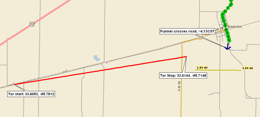
We got there a couple of minutes too late to see a tornado, but it is obvious the lowering with the wrapping rain curtains we shot crossing just south of us was the remnant circulation of that tornado. In the figure, red line is the tornado track, yellow line = 1 mile, and our position and look angle are shown by green dots and blue arrow respectively.
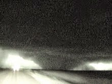
Heading back to Paris, we swung south on loop 236 and stopped at the intersection of 236 and FM 137. At about 4:25, a ragged rotating wall cloud was visible just to the west of our location. A narrow band of very low-level cloud tags was rapidly feeding into the circulation. Here is a pic of the wall cloud at time, looking west from 236/137. Time is ~4:25 CST
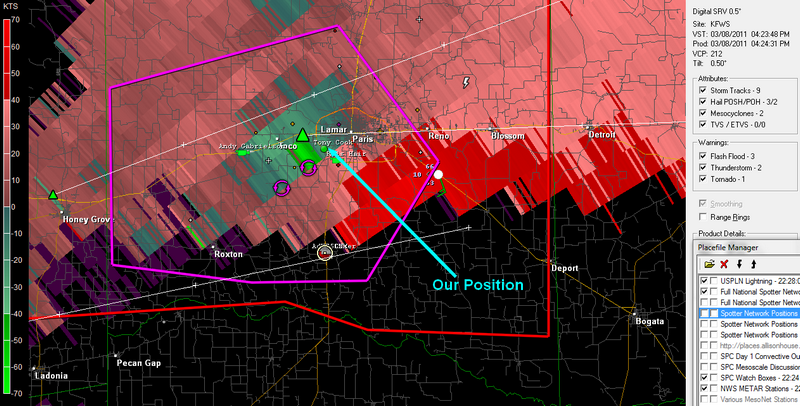
Here is a radar image of the circulation and our position from Spotter Net during this time frame (image courtesy of Adam Cuker).
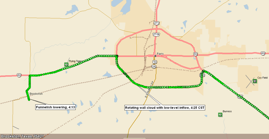
And here is our Delorme's GPS log showing our position and the position of the Paris and Brookston storm features we observed:
We moved east on 236 to the intersection of 236 and Hwy 271. The area of circulation approached, and we decided to head south on 271, rather than try to get up to 82 and follow the storm eastward. My thinking was that we could move SE on 271, then north out of Deport or Bogata and get back to cell. Did not want to trail it in the core.
Once we got to Bogata, we still could have moved N and intercepted the storm again, but new cells were now intensifying to the initial cell's SW. We decided to head back West and intercept the northernmost new cell. While we moved back NW on 271, the Paris cell produced at least on confirmed tornado east of Detroit. The same or a separate tornado also produced damage north of Clarksville along 82.
Electing not to trail the cell east out of Paris cost us a shot at seeing the tornadoes. Had we moved back up to 82 to follow the cell, there is still no guarantee we would have caught the tubes. From other reports, they were rain-wrapped and low contrast. Still, there is at least a decent chance we would have caught them had we been able to navigate around the core. Lesson learned- if you see visual indication of rapid low-level rotation, stay with it as long as you can safely do so. Do not assume the next storm in the line will also be rotating.
By near sunset, multiple cells had formed in a broken line from the initial tornado producer SW down to and south of I-20. We gingerly moved south, picking off a couple of these cells as we made our way home. Had some interesting after-dark scary-looking lowerings on a sub-severe cell south of Frankston, TX.
Depart Austin, TX: 9:45 a.m.
Arrive Austin, TX: 1:15 a.m.
875 miles , 16:30h
Chase Partner: John S
posted by Tony C at
10:23 AM
![]()

1 Comments:
This comment has been removed by a blog administrator.
Post a Comment
Subscribe to Post Comments [Atom]
<< Home