Chase Report: 19 May, 2010 - Hennessey to Stillwater, OK cyclic tornadic supercell

Left Shamrock, TX eastbound on I-40 at 10:15 a.m (all times CDT). Met up with fellow Austinites Bill Tabor, Randy Denzer, and non-Austinites Verne Carlson and Stephen Locke. Check out Stephen Locke's site TempestGallery for some amazing storm photography, btw. SPC upgrades much of Central OK to High Risk on the 1630 Day 1. The forecast wasn't difficult. Go on I-40 to West Central, OK, where satellite was showing a meso-boundary snaking from west to east in the vicinity of I-40.
Several of us ended up at Hwy 281 and I-40 when cells fired in NW OK. Randy and Verne immediately took off after the closest cell, while Bill and I dragged our feet. The cell looked wimpy on radar, but Randy texted us soon afterward telling us to get up there. Good thing- it began producing tornadoes early, even before it looked supercellular on radar. Check out Randy's video:
5/19 Tornadoes from Randy Denzer
Here was our view around the time the budding supercell was dropping its first tube.

Bill and I headed towards Watonga, then cut up to Hwy 51 to get to the storm quicker. We came out a little behind the cell, but caught it easily, as it was meandering down the highway at only about 25 mph. Here is a solid, low funnel just south of 51 at ~4:24:

My first tornado of the day was the large cone that went just NW of Hennessey. I shot the tornado from Cemetery Road (aptly named) a little north of Hwy 51. Here is my location and look angle at tornado initiation:

AND here is a sequence of stills, with some actual video hopefully to be added later. Note the historical Hennessey Cemetery in the foreground of many of these shots.


Here is helicopter view of the same tornado from an OKC TV network:
Apparently, I narrowly avoided a roadblock setup by OHP on Hwy 51 to prevent a horde of chasers from progressing east. Bill got caught by the same roadblock, and ended up losing the storm and having to bail south for the Guthrie cell. Caught up with Randy a little further down the highway- we would cross paths on and off for the rest of the day.
The supercell conveniently tracked due east along Hwy 51 for the next two hours, dropping tornadoes sporadically. I caught several of these, some of which lasted only a few seconds. Map of Tornadoes 2-4, all west of I-35:

Tornado #2, lasted ~1 min:


Tornado #3, lasted only a few seconds:

Tornado #4, lasted only a few seconds:

Continued east on 51 and crossed I-35 towards Stillwater. Map of Tornadoes 5-7:

Tornado #5 just east of I-35 was the most photogenic. It was in progress just to my WNW when I first saw it. It persisted for several minutes as a tall, thin cone. but was only obviously in contact with the ground for a small time, from my perspective. Here are a few video caps:


Tornado #6, lasted only a few seconds:

Funnel cloud (darker lowering, center) which produced tornado #7, with lightning, a few seconds before the tornado appeared:

Tornado #7, also brief from my vantage point, although topography quickly blocked my view of ground level:

Continued east on 51 into western Stillwater. OUN NWS has a report of a tornado based on damage just WNW of Stillwater at ~6:35. I was very close to this location, although I was moving at 6:35. At 6:38, I stopped and filmed NW towards a large, solid wall cloud with ground level obscured. OUN has not done a damage survey yet, and they based the time of their report on radar, so it is quite possible this feature contained a rain-wrapped tornado. No way to confirm, but here it is:

Here is the OUN NWS preliminary tornado reports. Not sure when surveys will be completed:
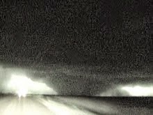
Funnel clouds continue through Stillwater and east until sunset, although I witnessed no more touchdowns, and OUN has no other reports logged. Here are a few of the funnels I witnessed, all of which exhibited strong rotation:


I went North on 99 to the intersection of 412 and 99, and continued filming rotating wall clouds with funnels. Finally let the Hennessey supercell go and went south towards the next set of cells. The sun had set, and storms began congealing into a big hybrid mess. Heavy rain made southward progress slow, and it became apparent I was not going to be able to position in time to catch the areas of the cluster with rotation. Turned back SW towards OKC, and drove home.
Here is the GPS track for the meat of the chase:

Depart Shamrock, TX: 10:15 a.m.
Arrive Austin, TX: 4:45 a.m.
830 miles , 18:30h solo chase
2 day chase total: 1670 miles
posted by Tony C at
9:55 PM
![]()

0 Comments:
Post a Comment
Subscribe to Post Comments [Atom]
<< Home