Twisted Texas: November 2011 <$BlogPageName$/> | <$BlogPageTitle$/>

Wednesday, November 9, 2011

Chase Report: 7 Nov, 2011 - SW Oklahoma Cyclic Tornadic supercell


Tornado intercept near Tipton,OK - 3:01-3:15CST


Tornado SSW of Snyder, OK, ~3:23 CS
T


The Details
Departed Austin with chase partner John S at about 7:30 a.m. Slight risk for southern plains, with hatched 10% tornado in SW OK:


Forecast parameters looked good for NW TX/SW OK, including 1000-1500 CAPE and nicely veered profiles. There was some concern that overly moist atmosphere and lack of Convective Inhibition would create conveyer-belt showers and hurt the prospects for discrete cells. Still, with a healthy November jet moving in, and such impressive forecast profiles, felt like it was worth a shot.

Initial target was Childress, TX. By the time we got to Anson, elongated cells were already forming in the east TX panhandle- several hours ahead of forecast initiation from the NAM or HRRR models. Decided to go NE to Vernon to try and stay in front of the activity. Caught initial cell near Quanah, TX and followed it across the Red River on 6. It produced several strongly-rotating lowerings, and one RFD that blew a huge red dust cloud over the vehicle. We did not witness a confirmed tornado from this cell. Images below from 2 p.m. CST, just south of the Red River.


Meanwhile a cell to our SE had quickly become supercellular as it crossed the River. We went South and East out of Olustee, and got our first glimpse of what would shortly become the Tipton tornado. Hail shaft, rain free base, and lowering already apparent, roughly 15 miles away. Time is 2:49, view is SE:

By the time we turned east on 5 and began to approach the town of Tipton, we had a great view of the back side of the cell, with a beautiful hail shaft obscuring a violent tornado in progress. Time is 3:01, view is east:


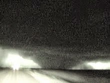
Shortly after driving through Tipton, we observed the big, dusty tornado as it crossed hwy 5C just to our east at 3:08 CST. Link to youtube video and stills below:

Here is our position for the picture above:

We move slightly east and stopped again, observing the Tipton Tornado move north. Time is 3:10-3:12 CST, view is N:


Over the next couple of minutes, the tornado ropes out. Time is 3:15, View NW:


Here is the NWS PNS regarding this tornado:
PUBLIC INFORMATION STATEMENT
NATIONAL WEATHER SERVICE NORMAN OK
400 PM CST THU NOV 10 2011

...TIPTON TORNADO RATING UPGRADED TO EF4...

BASED ON ANALYSIS OF DATA COLLECTED DURING A GROUND DAMAGE SURVEY...
THE RATING FOR THE NOVEMBER 7TH TIPTON TORNADO HAS BEEN UPGRADED TO
EF4 ON THE ENHANCED FUJITA SCALE. THE RATING IS BASED PRIMARILY ON
DAMAGE OBSERVED AT THE OSU AGRONOMY RESEARCH STATION ON HIGHWAY 5.

THIS IS THE FIRST NOVEMBER EF4 TORNADO IN OKLAHOMA SINCE RECORDS
BEGAN IN 1950.

ESTIMATED WIND SPEEDS IN AN EF4 TORNADO RANGE FROM 166 TO 200 MPH.
As the initial tornado was dissipating, a large low wall cloud formed and begin to produce brief vortices to our NE. Seconds later, the tornado consolidated. Time is still 3:15CST, view is ENE:


We drove east to Manitou, then north up 183, observing the tornado strengthen into a stout stovepipe. View approximately NE, time is 3:20 - 3:24.


The tornado began to weaken as it appraoched 183. It produced this needle funnel in the center of the broad circulation, and seemed to rapidly dissipate shortly thereafter. View is North, time 3:25 CST:


Here is out track and the approximate tornado track during this intercept:


We went east on 62 east of Snyder, where we observed this brief tornado just north of the highway. Time is 3:38, view N.


I believe this tornado briefly had a satellite tornado, but was unable to video this feature. During this same time frame, observed a white funnel under a separate circulation which produced a couple brief surface spinups. Time is 3:40, View N:


Turned north on 54, and then east on mud road E1590. John kept us between the ditches on the treacherous mud roads for the next few minutes, and we witnessed the initial stages of the Wichita Mountain tornado. Time is 3:51, view is E:

We took “Scenic Highway” east, hoping we could catch the cell once we got to the other side. This strategy failed miserably, but we were able to witness the large tornado from time to time when terrain was favorable. Time is after 4:07, view is NNWish:

Here is our position for this leg of the chase, up until the GPS software failed.


Slow traffic and wandering Buffalo killed any hope of catching the cell again.

We dropped south to Wichita Falls, and then to Electra where we intercepted another supercell shortly after sunset. By the time we got to it, the storm had weakened below severe limits, and we ended the chase.

NWS Norman page on Nov 7 tornadoes

Depart: Austin, TX 7:30 a.m.
Arrive: Austin, TX 12:30 a.m.
980 miles, 17 hours

Chase Report: 24 May, 2011 - Goldsby, OK EF4


EF4 Tornado near Washington, OK - ~5:55 CDT

High risk for Central and Northern OK. The associated Tornado prob from the 1630Z outlook shown below, with huge 45% hatched contour.


Solo chase. My forecasted target was around the OK/KS border, Alva, OK to Medicine Lodge, KS. Fortunately, I was working all morning and did not get out of the driveway until about 12:30 p.m. While there was action at the Northern target, Central OK ended up being the breeding ground for the strongest tornadoes of the day. Stopped just north of Fort Worth at the I-35/287 junction around 3:15 CDT. Severe cells were in progress to my west within a couple of counties. Broken line of supercells had fired on the dryline W and NW of OK City. Made a quick decision to shoot north and try to get to the southern end of the Central OK storms. Within a few minutes of that decision, three of the Central OK storms went tornado-warned.

Made good time moving up 35, but cell motion was NNE at the time, and fast- 45-55 knots (I think). Around 4 p.m., crossed the Red River. The most damaging tornado of the day was already in progress. It would go through El Reno and Guthrie over its 75 mile track, and cause 9 fatalities. This tornado has been rated EF-5 based on radar data collected by a mobile radar.

As I approached Purcell, OK, a new cell that had formed south of the original OK line went tornado-warned near Bradley. I had no data for a long stretch about this time. Got some much needed help from chasing partner John S, who was unable to go with me on the trip. There were two cells within range, both with tornado warnings. The northern cell produced an EF4 from Chickasha to Moore, and at the time had a better radar presentation. However, I did not think I could get up to it in time, and the hail core from the southern cell was already over I-35. I decided to pull off and try to get the Bradley tornado.

Took exit 101 (Ladd Rd), and pretty quickly had a visual on the southern edge of the rain free base. Contrast was poor and I was taking some small hail with an occasional larger stone. Moved slightly west to Pacer Field, and about 5:52, a tall stovepipe tornado in progress came into view to my Southwest.


I reported the tornado and observed it for several minutes as it got closer. Initially thought it would track over my location, but it ended up turning north towards the end of its life cycle according to the current survey details (survey not yet finalized). That is consistent with what I observed.

While observing this tornado, a new lowering formed to my immediate west. It quickly began to produce a funnel cloud and shortly after that, at around 5:58, it kicked up a debris cloud within 100 yards of my location.


While it did not look to be a very strong tornado, I had to relocate quickly to avoid getting hit. The new tornado went past me- technically, I was probably in the outer edge of the circulation- but it remained weak and dissipated once it crossed I-35. The main tornado was roping out by this stage, and completely dissipated shortly after 6 p.m.


Here is the preliminary NWS survey of the Goldsby tornao:

STORM 4... WASHINGTON-GOLDSBY
PRELIMINARY DATA...
EVENT DATE: MAY 24, 2011
EVENT TYPE: TORNADO
EF RATING: EF-4
ESTIMATED PEAK WINDS (MPH): 190
INJURIES/FATALITIES: UNKNOWN/NONE
EVENT START LOCATION AND TIME: 4 SW BRADLEY 5:26 PM CDT
EVENT END LOCATION AND TIME: 1 NW GOLDSBY 6:05 PM CDT
DAMAGE PATH LENGTH (IN MILES): 27 MILES
DAMAGE WIDTH: UNKNOWN

Continued chasing eastward on I-40 past sunset, narrowly missing a tornado near Shawnee reservoir, and observing numerous lowerings and a couple of possible tornadoes after dark. Finally stopped at Hulbert, and about 9:45 CDT, decided to end the chase, as I had to be at work the next morning. Crossed the path of the April 14 Tushka/Atoka EF3 shortly after midnight, and arrived back in Austin around 5 a.m.

Another bad day for strong tornadoes hitting populated areas, and a well-deserved high risk call by SPC. I was happy with most of my chase, especially considering how late I started. Missing a couple of minutes of the Washington-Goldsby rope out, and missing at least one other late tornado was frustrating. Still, this was a difficult day with multiple HP cell interactions and fast NE storm motion. Impossible to stay with cells for long when the road network runs mostly NS and EW. A lot of chasers had trouble and went home empty-handed, so I am just glad I got up there in time for one of the main tornadoes.

Special thanks to John S for nowcasting during the crucial Goldsby intercept and later in the evening also to help keep me close to good cells.

NWS Norman page about the outbreak

Depart: Austin, TX 12:30 p.m.
Arrive: Austin, TX 5:00 a.m.
1020 miles, 16.5 hours
Solo chase